Salse di Nirano


Notizie storiche, culturali e paesaggistiche del contesto:
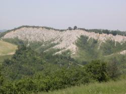
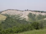
Le Salse si trovano sulle prime colline del modenese, fra campi e calanchi. Nelle vicinanze è l’abitato di Fiorano Modenese dove negli anni ’40 venne ritrovato un insediamento preistorico. La particolare declinazione della tipologia neolitica riscontrata ha preso il nome di Cultura di Fiorano. Sempre a breve distanza è la cittadina di Sassuolo, che fu libero comune, passò agli Estensi nel 1417 che la elessero, a partire dalla seconda metà del Seicento, a residenza di villeggiatura e la dotarono di un vastissimo parco. Oggi il comprensorio di Fiorano e Sassuolo è noto soprattutto per l’industria ceramica che sfrutta i depositi di argilla assai diffusi nella zona.
loc. Nirano (presso)
Fiorano Modenese (MO)
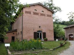
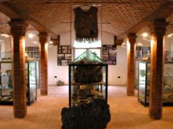
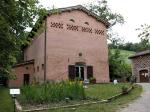
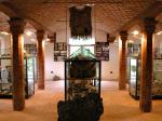
La riserva della Salse, istituita nel 1982, si può visitare seguendo i percorsi ben segnalati e corredati da cartelli esplicativi. Uno di questi percorsi porta ad un vecchio edificio accuratamente ristrutturato che accoglie il Centro Visite con materiale informativo e una piccola raccolta di reperti geologici, fossili e floro-faunistici dell’area. Sono previste anche attività didattiche e scientifiche.
Caratteristiche delle acque:
salse (inclusi sottogruppi)
Personalità collegate:
Plinio il Vecchio (scrittore, naturalista, filosofo)
Antonio Stoppani (geologo)
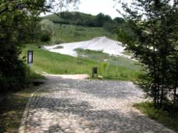
All’interno del Parco delle Salse si snodano diversi sentieri che permettono di visitarlo senza danneggiare i vulcanetti e la vegetazione. In particolare:
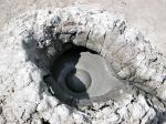
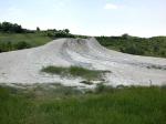
- Percorso delle Salse, che si snoda intorno alla conca delle salse permettendo di osservare gli apparati lutivomi sia avicino, sia in panoramica;
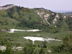
- il Sentiero dei Tritoni, che si sviluppa lungo il fondovalle del Rio delle Salse-Rio Serra fino a raggiungere due laghrtti artificiali dove è possibile l'osservazione dell'avifauna e di esemplari di tritone;
- Percorso del Rio Chianca, lungo il quale vi sono alcuni punti panoramici da cui si possono osservare i calanchi e una palude;
- Sentiero dei Calanchi, che percorre per un buon tratto il fondovalle del Rio Chianca e consente l'osservazione dal basso di numerosi calanchi;
- Sentiero del Riccio, inizia dal parcheggio della riserva e costeggia la strada comunale delle Salse;
- Stradello del Gufo, che da accesso al centro visite
Notizie storiche, culturali e paesaggistiche del contesto:
Le Salse si trovano sulle prime colline del modenese, fra campi e calanchi. Nelle vicinanze è l’abitato di Fiorano Modenese dove negli anni ’40 venne ritrovato un insediamento preistorico. La particolare declinazione della tipologia neolitica riscontrata ha preso il nome di Cultura di Fiorano. Sempre a breve distanza è la cittadina di Sassuolo, che fu libero comune, passò agli Estensi nel 1417 che la elessero, a partire dalla seconda metà del Seicento, a residenza di villeggiatura e la dotarono di un vastissimo parco. Oggi il comprensorio di Fiorano e Sassuolo è noto soprattutto per l’industria ceramica che sfrutta i depositi di argilla assai diffusi nella zona.
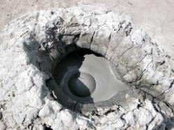
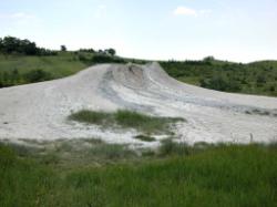
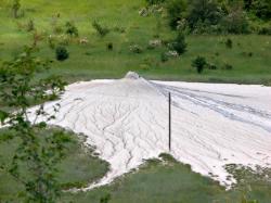
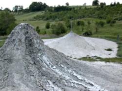
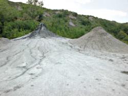
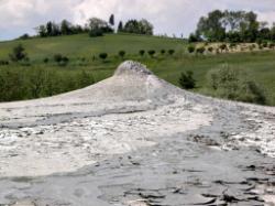
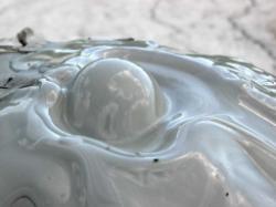
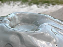
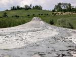
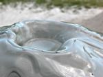
This appearance is due to the pressure of the gaseous hydrocarbons, which return to the surface from the depths of the subsoil, dragging fossil seawater, clay and bituminous materials with them. The effect is similar to the boiling of a pot, although the materials that come out of it are actually cold. The Salse Park, with low vegetation and some woody maquis, interrupts the landscape of cultivated fields and erosion furrows that surround it.
The reserve, established in 1982, can be visited by following the well-signposted routes, marked with explanatory notices. One of these routes goes to an old building that has been carefully restructured, which contains the Visitors Centre. Here you will find information and a small collection of geological finds, fossils and flora-fauna of the area. Educational and scientific activities are also carried out here.
Mineral water characteristics:
saltwater (including all subgroups)
Personalities:
Plinio il Vecchio (author, naturalist, philosopher)
Antonio Stoppani (geologist)
Several paths wind through the Salse Park, making it possible to visit it without damaging the mud cones and the vegetation. In particular:
- The Salse Trail: winds around the basin of the Salse allowing one to observe the boiling mud cones both close by and from afar;
- The “Tritoni” (Newts) Trail: it winds along the bottom of the valley of the Rio delle Salse/Rio Serra until it reaches two artificial lakes, where it is possible to see the birds and animals and some types of newts; from here it continues along the ridge;
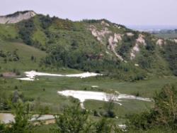
- The Rio Chianca Trail: along the route there are some viewpoints from which one can see the erosion furrows close up, and an example of a marsh;
- The “Calanchi” Trail: it runs along the bottom of the valley of the Rio Chianca for quite a distance, and permits observation of the bottom of several erosion furrows;
- The “Riccio” (Hedgehog) Trail: the path starts from the Reserve car park and runs along the side of the municipal road of the Salse.
- The “Stradello del Guffo” (Lane of the Owl): access lane to the Ca' Tassi Visitors Centre.
In the nearby Terme della Salvarola, mud baths were, for some time, used for treatment purposes, after sterilisation because of the presence of anaerobic bacteria. Since 1982 the area is a nature reserve and the particular salt-water flora (adapted that is to living on brackish land) which has found a favourable environment here is therefore also protected.
Historical, cultural and landscape context information:
The Salse are located on the first hills of the Modenese, among fields and erosion furrows. The town of Fiorano Modenese is nearby where, in the 1940s, a prehistoric settlement was rediscovered. This particular Neolithic typology is known as Fiorano Culture. A short distance away is the town of Sassuolo, which was a free city-state, passed to the Este family in 1417 who, from the second half of the seventeenth century, established it as a holiday residence, and provided it with an enormous park. Today the district of Fiorano and Sassuolo is particularly known for the ceramic industry, which uses the deposits of clay that are quite widespread in the area.


